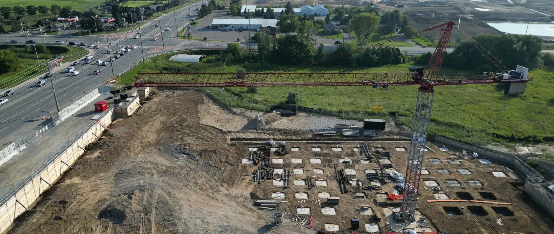
Drones have become increasingly popular in the construction and land development industries due to their versatility and numerous applications. Construction and land development services are available for Hamilton, Burlington, Oakville, Kitchener-Waterloo, Guelph, Georgetown, Mississauga, Brampton, Vaughan, Richmond Hill, Markham, and Toronto. See Construction Survey and Inspection Cost here. Some of the primary applications for using them in construction and land development include:
Drones equipped with high-resolution cameras capture detailed aerial imagery as well as topographic data of construction properties. This data provides accurate information about the existing terrain, vegetation, infrastructure, and potential obstacles, enabling precise site assessment and surveying.
By capturing a series of overlapping images and stitching them together, drones create highly detailed and georeferenced orthomosaic maps. These maps provide a comprehensive and up-to-date visual representation of the construction development site, showcasing accurate measurements, boundaries, and other essential details. Orthomosaic mapping aids in project planning, design, and collaboration among stakeholders.
Drones provide an efficient means of tracking construction development progress and documenting the various stages of a project. By regularly making use of aerial photography or conducting aerial surveys, comprehensive site views are achieved. Thus, it allows project managers and stakeholders to monitor progress, identify potential issues, and make informed decisions in a timely manner.
Drones can accurately measure stockpile volumes of construction materials on development properties. This information helps construction companies and land developers optimize inventory management, prevent shortages or overstocking, and minimize waste. It provides a quicker and more precise alternative to manual measurements, saving time and reducing human error.
Drones can access difficult-to-reach or hazardous areas, providing valuable data for safety inspections and risk assessments. By capturing aerial imagery or conducting real-time video inspections of difficult to reach structures, drones help identify potential safety hazards, monitor compliance with safety regulations, and facilitate proactive risk management strategies. This improves overall project safety and reduces the risk of accidents.
Aerial media, whether site photography or videography, offers captivating visual content for marketing purposes and stakeholder communication. Stunning perspectives of completed projects are captured, showcasing architectural designs, or providing virtual tours of land development projects. It enhances marketing campaigns, facilitates client presentations, and improves stakeholder engagement.
Drones equipped with high resolution cameras effectively assess environmental factors such as vegetation health, water management, or soil erosion. Collected data aids in environmental impact assessments, compliance with environmental regulations, and proactive monitoring of potential ecological risks.
Drones provide a cost-effective and efficient solution for inspecting structures, such as bridges, rooftops, or wind turbines. Equipped with large frame sensor cameras, they capture high-resolution images, enabling quick and accurate inspections. This helps detect defects, identify maintenance needs, and reduce the need for costly and time-consuming manual inspections.
By leveraging aerial media data in these various applications, construction companies and land developers monitor progress while optimizing project planning, streamlining operations, producing enhanced mapping, and achieving significant cost-savings throughout the project lifecycle.