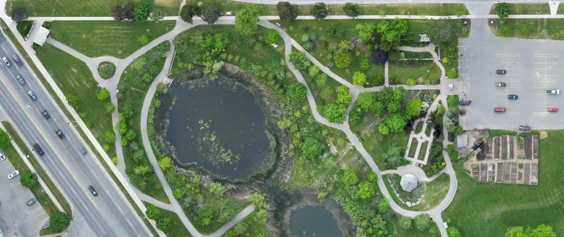
In today's fast-paced construction industry, companies are constantly seeking innovative solutions to streamline processes, improve productivity, and reduce costs. One such groundbreaking technology that has revolutionized the field is drones. They offer a wide range of applications, and two particularly valuable services are orthomosaic mapping and stockpile measurement. Orthophotography services are available for Hamilton, Burlington, Oakville, Kitchener-Waterloo, Guelph, Georgetown, Mississauga, Brampton, Vaughan, Richmond Hill, Markham, and Toronto. See Orthophotography Cost here. The following explanations will explore how this technology can benefit your Toronto based business by addressing the fundamental processes involved.
Toronto construction companies and land developers of all sizes can benefit significantly from drone services for orthomosaic mapping and stockpile measurement. Whether you are a small-scale residential builder or a large-scale infrastructure developer, the applications of these services are versatile and cater to a wide range of needs.
Orthomosaic mapping is the process of capturing aerial imagery and stitching the individual images together to create a high-resolution, georeferenced, and orthorectified map of your Greater Toronto Area construction site or land development project. This detailed and accurate visual representation provides invaluable information for project planning, progress monitoring, and documentation.
Stockpile measurement involves using drones to collect data of raw material volumes, and process calculations in software. By capturing aerial images they accurately measure the volume of materials such as soil, gravel, or sand, saving time and reducing human error associated with traditional manual methods.
They are utilized at various stages of a construction project or land development initiative. They are particularly useful during the pre-construction phase for site assessment and feasibility studies, as well as throughout the project for monitoring progress, managing inventory, and ensuring compliance with specifications.
Enhanced Planning and Design: The detailed and up-to-date aerial imagery provided by orthomosaic mapping helps construction companies and Toronto area land developers in better planning, designing, and visualizing the project. Accurate data on Toronto area topography, terrain, and existing infrastructure informs decisions related to grading, drainage, and utilities placement, optimizing project efficiency.
Improved Project Monitoring: Regular orthomosaic updates allow for real-time monitoring of progress. This enables stakeholders to identify potential issues early on, make informed decisions, and proactively manage resources and schedules. Timely interventions can prevent delays, reduce rework, and ultimately save costs.
Efficient Inventory Management: Measuring raw material inventories using drones eliminates the need for manual measurements, which are time-consuming and prone to errors. Accurate volume calculations help construction companies and land developers optimize material usage, plan for timely replenishment, and minimize waste. This ensures cost-savings by avoiding overstocking or shortages.
Safety and Risk Mitigation: Drones can access hazardous or hard-to-reach areas without endangering human lives. They capture valuable data on site conditions, identify potential safety hazards, and aid in risk mitigation strategies. This proactive approach minimizes accidents, reduces insurance premiums, and enhances overall project safety.
Engage a Professional Drone Service Provider: To leverage the benefits of orthomosaic mapping and stockpile measurement, it is essential to partner with a reputable and reliable service provider. Look for a company that specializes in construction and development projects, possesses the necessary certifications and permits, and utilizes state-of-the-art equipment.
Define Project Objectives: Clearly communicate your project objectives, timelines, and deliverables to the drone service provider. This will ensure that the orthomosaic maps and stockpile measurements are tailored to your specific requirements. Collaborate closely with the provider to establish the flight plans, data collection schedules, and desired accuracy levels.
Data Processing and Analysis: Upon collecting necessary aerial data, it is processed using advanced photogrammetry software to generate accurate orthomosaic maps and stockpile measurements. The drone service provider will analyze the data and provide you with actionable insights, which can be integrated into your project management software for seamless decision-making.
This emerging technology offers construction companies and developers powerful tools to enhance planning, streamline operations, and achieve significant cost-savings. By utilizing this cutting-edge technology, you potentially gain a competitive edge in the industry, improve project efficiency, and mitigate risks. Embrace these services, partner with a reliable service provider to unlock the full benefits of emerging technologies for your construction and development projects.